AgriCaptureCO2 services
EXPLOREAssess how sustainable practices affect fields, farms, and incomeChange is never easy, particularly when abandoning tried-and-tested agricultural practices for new ones. Throughout the ‘explore’ stage,
Open-Earth-Monitor – A cyberinfrastructure to accelerate uptake of environmental information and help build user communities at European and global levels
Open-Earth-Monitor is a EU-Horizon Europe funded project that aims at building an open-source cyber-infrastructure to accelerate uptake of environmental information and help build user communities
Open Soil Spectral Library
Soil Spectroscopy for the Global Good is a Coordinated Innovation Network funded by USDA NIFA Food and Agriculture Cyberinformatics Tools Program (Award #2020-67021-32467). This project
Erasmus+ SATI – GILAB created Dissemination Video
GILAB created the video in collaboration with EIEO, MKV Consulting, UPA, and SPIRITO. The Video will be used as promotional material and for training purposes
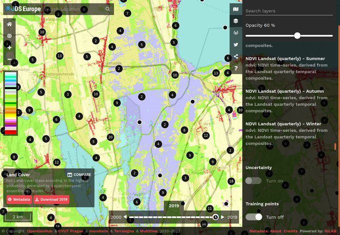
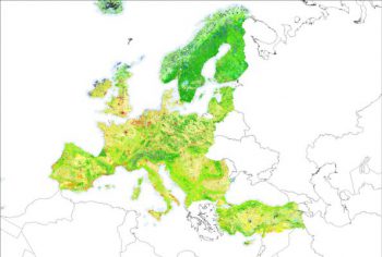
Geo-harmonizer – Gilab team has developed an application and services
Gilab in collaboration with OpenGeoHub, CVUT Prague, mundialis, Terrasigna, MultiOne has released Open Data Science Europe data portal on 1st of March 2021. It comprises terabytes of gridded data available as
AgriCapture – Developing EO-powered services to promote soil carbon sequestration through regenerative agriculture
Accounting a climate footprint is an established practice. However, accounting for C capture is largely based on manual methodologies that cannot be easily scaled. The
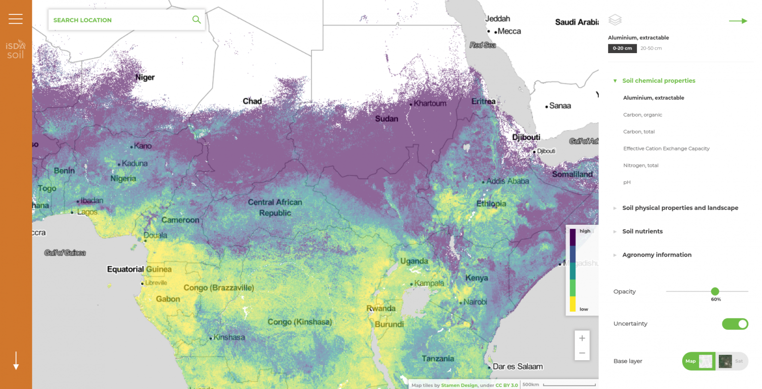
iSDAsoil
GILab team participated in the project – iSDAsoil, more precisely, GILab team developed a Web GIS solution that provides soil information for the African continent.
GEOBIZ: Strengthening the capacity of academic institutions to better meet the needs of emerging geoinformatics industries in the Western Balkan countries and Moldavia
GEOBIZ is an Ersamus project aiming at: Establishing new and innovative forms of business-academic collaboration to support interaction in geoinformatics teaching / learning processes. Establishing
DIAD: Design & Impact Assessment Dashboard for Ethiopia
GILab, in collaboration with Wageningen University & Research (WUR) and GIZ Ethiopia, will develop a web-based prototype for Design and Impact Assessment Dashboard (DIAD) for
DIONE: an integrated EO-based toolbox for modernising CAP area-based compliance checks and assessing respective environmental impact
DIONE, a H2020 project, proposes a close-to-market (TRL7) area-based direct payments monitoring toolbox that will address the forthcoming Modernised CAP regulation of using automated technologies
CORINE Land Cover 2018
GILAB was a partner in a consortium that has been awarded a contract by European Environment Agency (EEA) for an implementation of a project entitled “Copernicus Land
CropLab
Demo app for crop monitoring support tool. It provides support to farmers by helping them monitor growth on their farms. In the background, this application
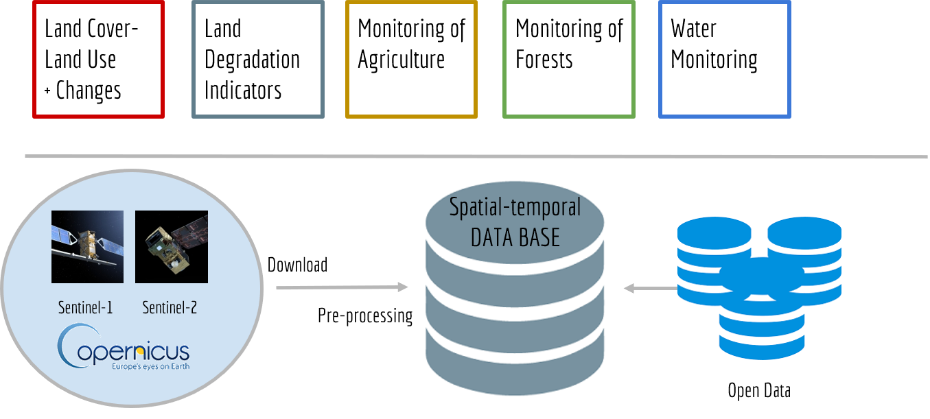
Land Information and Monitoring Service
Technical solution and implementation plan for multipurpose Land Information and Monitoring Service for Montenegro. The proposed system should be based on a hyperresolution spatiotemporal land
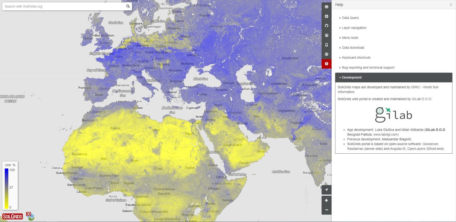
SoilGrids 2015-2019
GILAB team made web mapping client for “Soil property maps at 250 m” based on the AngularJS and OpenLayers, 3D client based on the CesiumJS. We made upgrade of REST SoilGrids
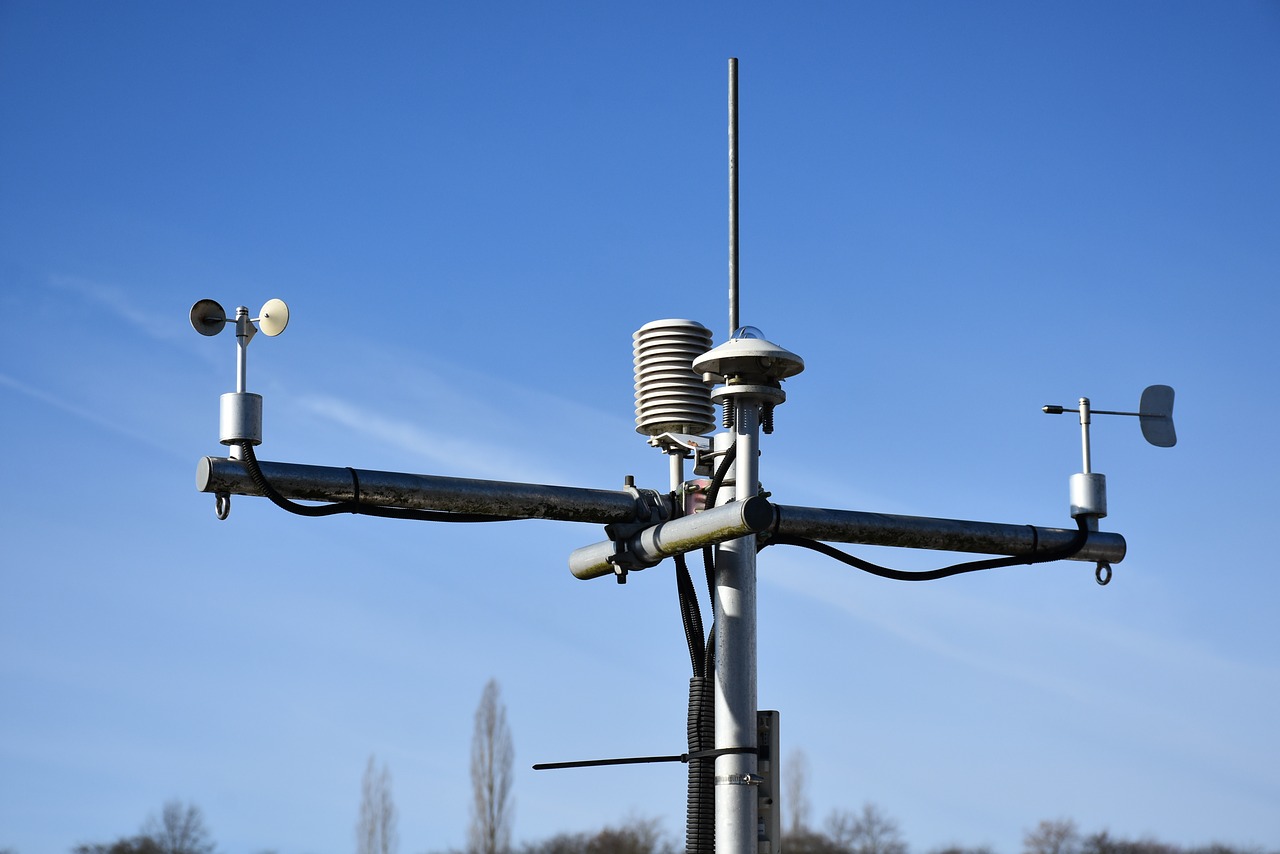
Meteo Database
Technical solution and implementation of meteorogical measurements database system. Automatic integration of different data formats and sensors, storing and displaying them through istSOS service which employs OGC
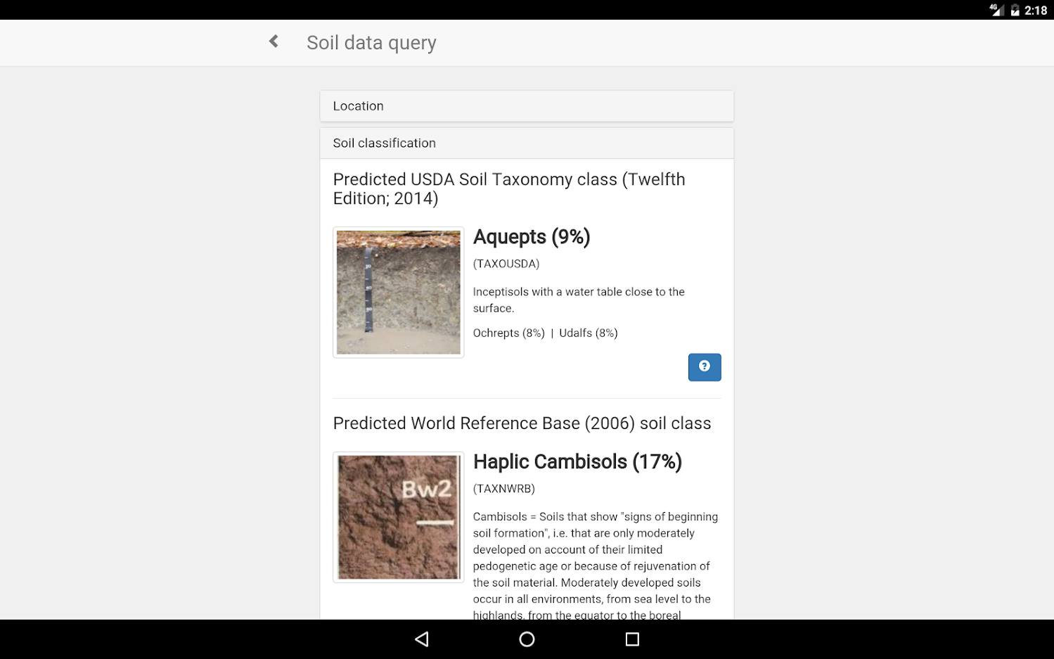
SoilInfo 2015-2019
Development of web/Android/iOS app realization of the SoilInfo app. The SoilInfo App is the mobile component of the Global Soil Information Facilities (GSIF). Its main
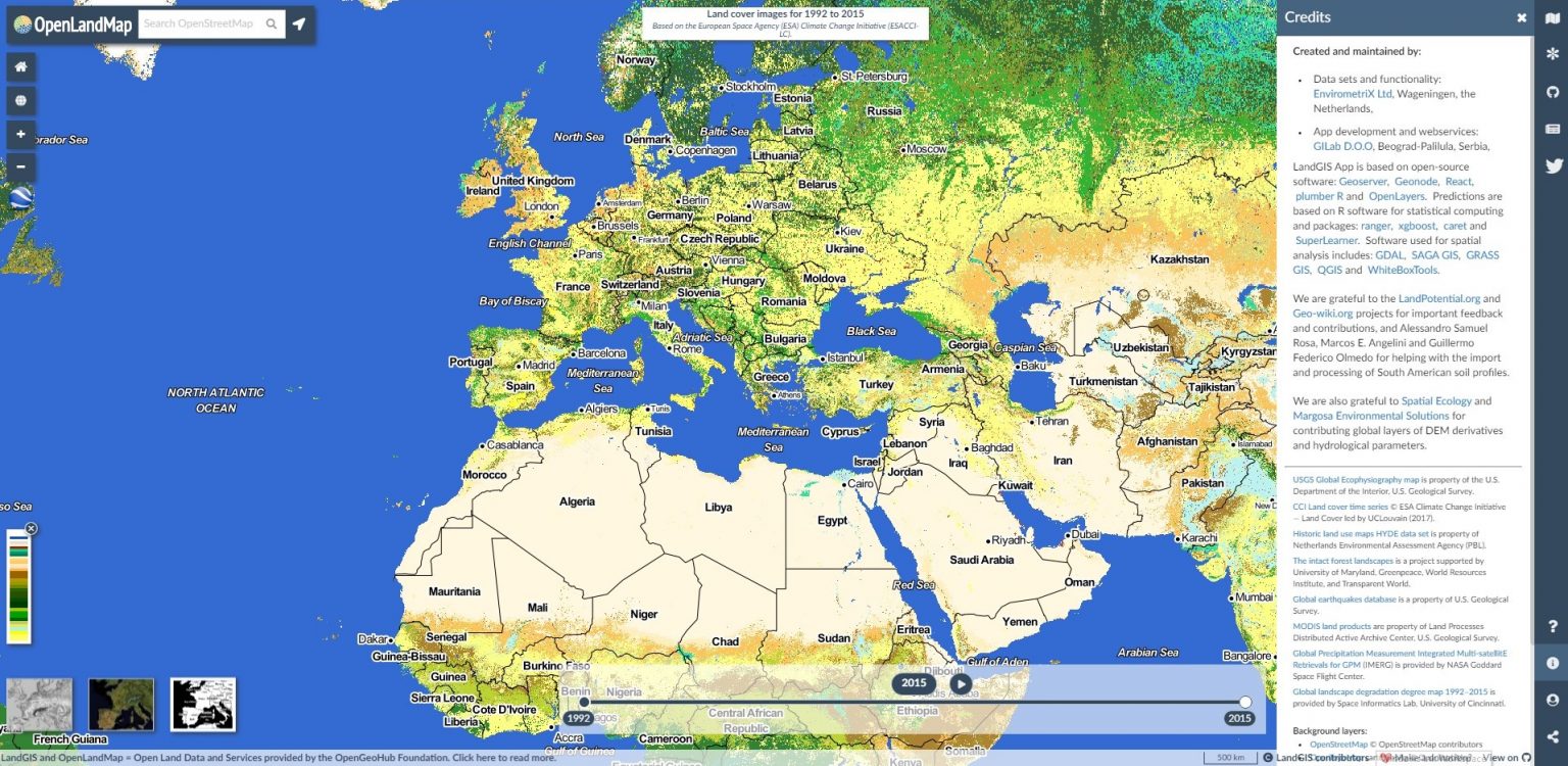
OpenLandMap
GILab team has developed LandGIS – Web GIS system that consists of (1) Web mapping client, which provides visualization of various spatio-temporal land-related datasets and enables querying per