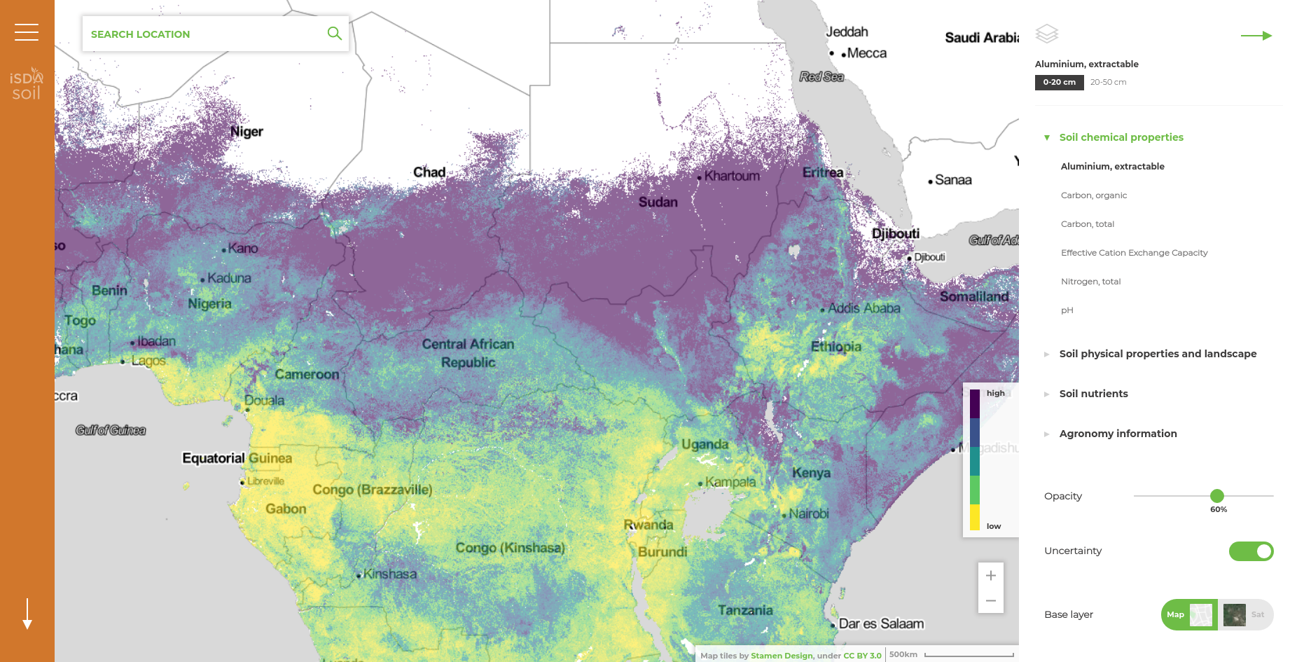
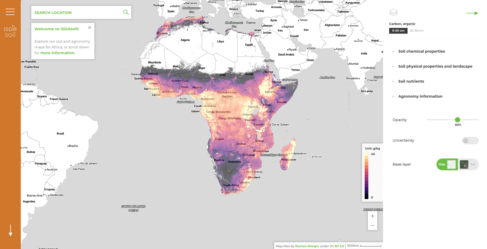
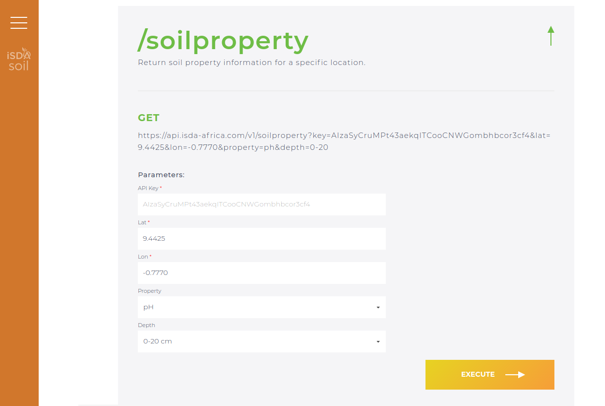
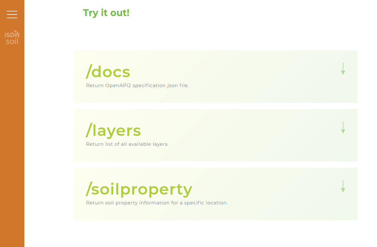
GILab team participated in the project – iSDAsoil, more precisely, GILab team developed a Web GIS solution that provides soil information for the African continent. The developed GIS solution consists of (1) Web mapping application, that enables visualization of multiple soil-related spatial data and querying specific locations for each dataset and (2) REST API that enables performing a customized spatial query with several parameters at user’s disposal such as longitude, latitude, property and depth (see Developer Portal for more information).