SoilGrids 2015-2019
GILAB team has developed a professional web mapping client for “Soil property maps at 250 m” using AngularJS and OpenLayers, along with a 3D client powered by CesiumJS. Additionally, we have enhanced the REST SoilGrids API, integrated OGC web mapping services through Geoserver, incorporated download functionalities utilizing Rasdaman and FTP, and established a robust metadata […]
Meteo Database
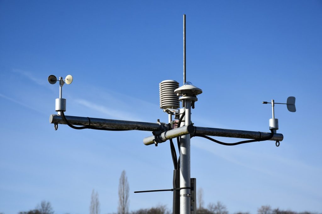
We have developed a comprehensive technical solution for the implementation of a meteorological measurement database system. This system seamlessly integrates data from various formats and sensors, automating the process of data collection, storage, and presentation through the utilization of the istSOS service, which adheres to the OGC SOS standard, ensuring robust and standardized data management. […]
SoilInfo 2015-2019

The SoilInfo App serves as the mobile component of the Global Soil Information Facilities (GSIF), seamlessly providing access to soil data derived from the SoilGrids project. Moreover, it efficiently enables the presentation, distribution, and querying of diverse data components, encompassing soil profiles and samples. For more information, please visit the project’s website. To see the […]
OpenLandMap
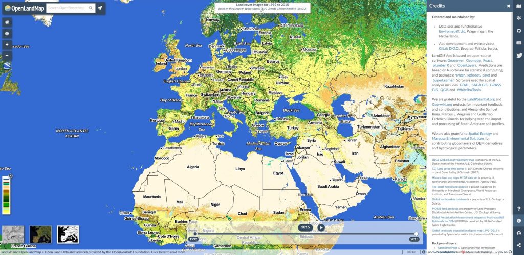
The GILab team proudly introduces LandGIS, a comprehensive Web GIS system. It includes a powerful Web mapping client for data visualization, a versatile LandGIS REST API for efficient querying, and a user-friendly Data Store based on GeoNode for layer metadata management. Explore LandGIS and learn more about GILAB projects and products.
Exploration
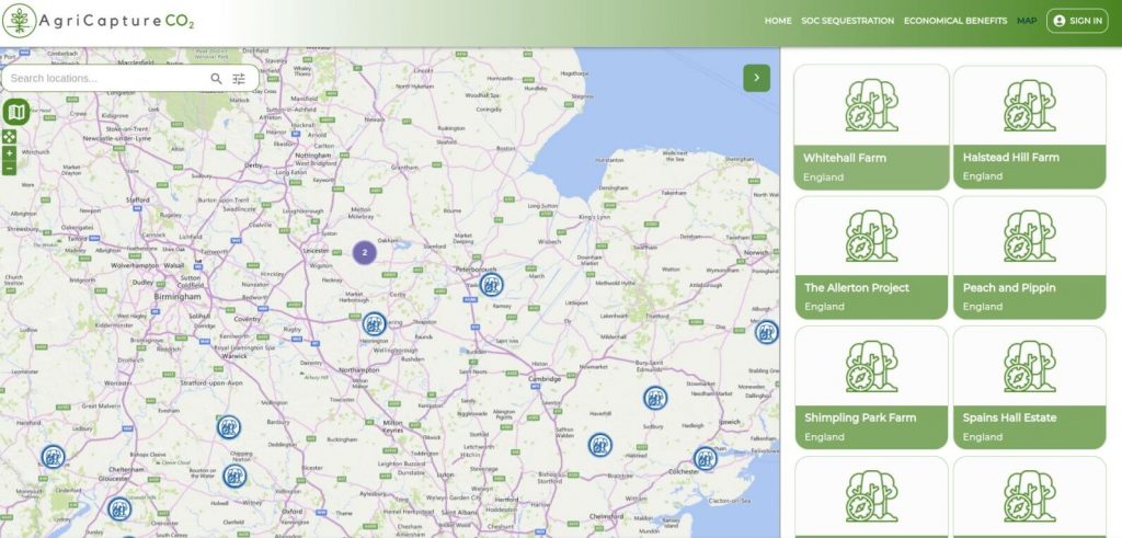
Exploration: Nurturing the Future of Sustainable Agriculture 🌱 Explore the world of regenerative practices with Exploration, a web application designed to showcase a global map featuring farms that actively implement regenerative farming methods. With a simple click, access essential information about each farm, including their sustainable practices and more. Join our community and contribute by […]
CropLab: Your Partner in Agricultural Excellence, Now on Mobile

CropLab is your indispensable companion throughout the agricultural cycle, dedicated to helping you achieve exceptional results. Our platform empowers farmers and agronomists with detailed insights into critical crop indicators, shaping and enhancing crop conditions. With CropLab, you gain access to precise information that drives efficient input management, optimizing resource utilization. This translates to increased yields […]
DailyMeteo
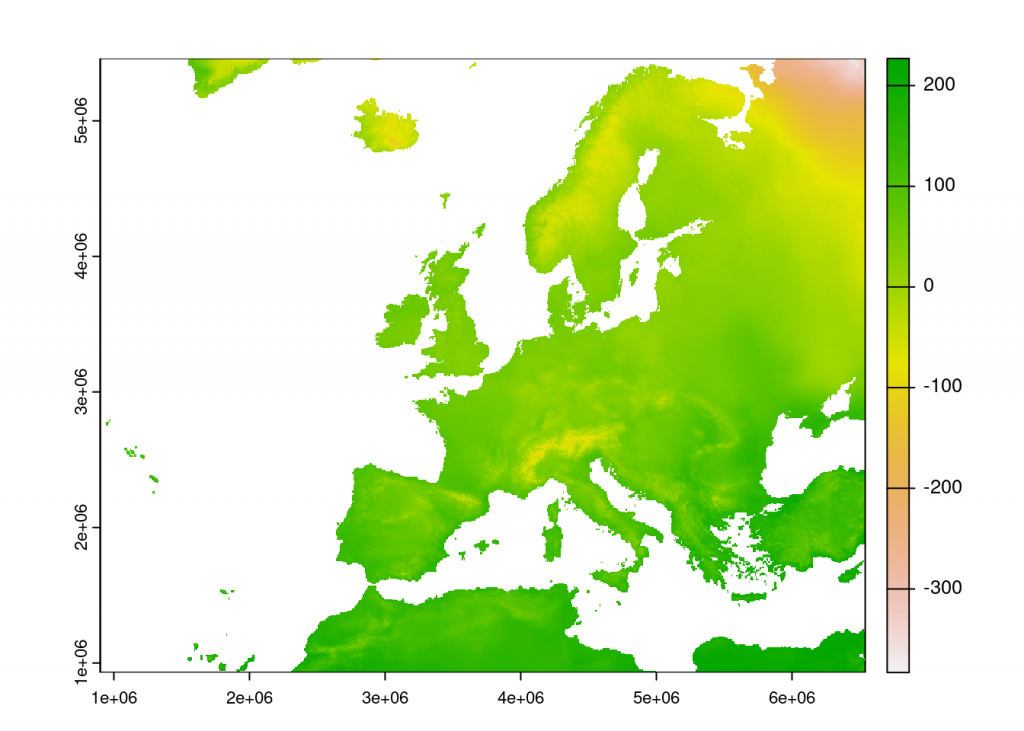
DailyMeteo: High-Res Meteorological Data at Your Fingertips DailyMeteo provides access to high-resolution meteorological data with a spatial resolution of 1 km for Europe and the world. Using advanced geostatistics and machine learning, we process data from sources like GHCN-daily, ECA&D, OGIMET, and GSOD. Our platform operates in near-real-time, offering monthly and annual summaries and long-term […]
CO2AGRI
Coming Soon: CO2AGRI – Your Precision Partner for Sustainable Farming CO2agri is a cutting-edge application designed for the meticulous assessment of regenerative agricultural practices on farms. Leveraging Earth Observation data, this app offers a rigorous verification process to confirm the implementation of regenerative agricultural techniques. Within the application, users can effortlessly generate a range of […]
Find & Collect

Find & Collect is a mobile app for collecting locations of various types. With Find & Collect you can navigate yourself to collected locations and attach geo-tagged photos to them. Collected points and photos are at your disposal through user-friendly interface and you can share them with others easily. Aside from abovementioned, if you are […]
CropLab – Your personal digital laboratory
How CropLab can help you? CropLab supports you in every step of the agriculture cycle to obtain outstanding results What CropLab Does CropLab enables farmers and agronomists to access detailed information about critical indicators that define and/or influence the crop status. This ensures a more cost- efficient input management, resulting in higher yields and wiser […]