Gilab Co-Founder Milan Kilibarda Speaks on AI in Agriculture at Novi Sad Agricultural Fair
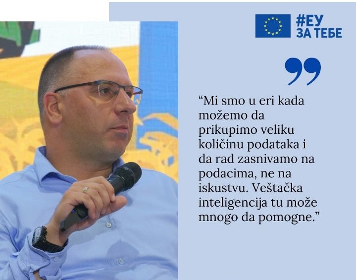
Milan Kilibarda, co-founder of Gilab, recently participated in a panel discussion at the Agricultural Fair in Novi Sad, focusing on the transformative impact of artificial intelligence in agriculture. The discussion, featuring insights from Dejan Zorić of AgroTech and Gordan Zorić of the BioSens Institute, explored how AI can revolutionize the agricultural sector and usher in […]
Digital technologies in the service of regenerative agriculture
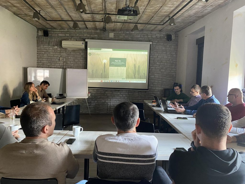
On the 12th of December a workshop and training for regenerative farmers was held, titled “Digital technologies in the service of regenerative agriculture”. The workshop was organized by the Regenerative Agriculture Alliance of Serbia, as a part of the AgriCapture project, coordinated by GILAB DOO, one of the founding members of the Alliance. The workshop […]
Open-Earth-Monitor
This project is currently in progress, and we are excited to announce that we will soon be unveiling the initial results of the application we are developing. Stay tuned for updates and follow our progress. For more information, please visit our project section or check out the official project presentation.
Open Soil Spectral Library

You can access the application through the following link: https://soilspectroscopy.org/ For more detailed information about the project, please refer to the documentation provided HERE. This project is also prominently featured in our project portfolio.
Geo-harmonizer
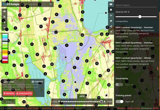
For more information on accessing and utilizing this valuable resource, as well as an exploration of its advantages and limitations, please visit Open Data Science Europe Data Portal.
AgriCaptureCO2
For more detailed information about the services offered within the project, please visit AgriCaptureCO2 Services.You can find additional project-related details on the website: AgriCaptureCO2.
iSDAsoil
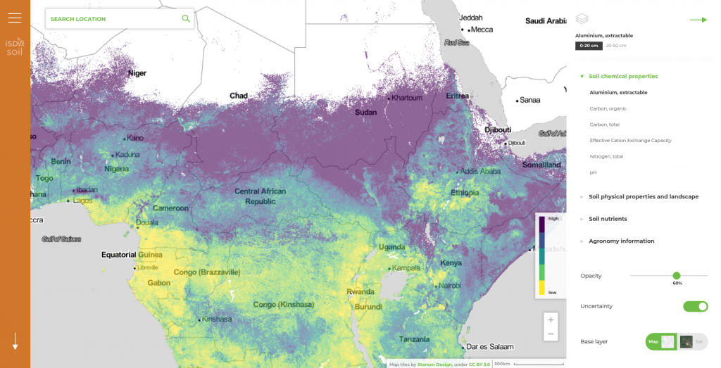
This innovative GIS solution encompasses a web mapping application, facilitating the visualization of various soil-related spatial data and offering the capability to query specific locations within each dataset. Additionally, it features a REST API, empowering users to perform customized spatial queries with user-defined parameters, including longitude, latitude, property, and depth, as detailed in the Developer […]
DIAD: Design & Impact Assessment Dashboard for Ethiopia

This innovative tool was created for conducting Ethiopian landscape analysis and impact assessments, facilitating the monitoring of key performance indicators (KPIs) at both site and landscape levels. These KPIs encompass physical, agronomic, and socio-economic aspects and make extensive use of remote sensing and other advanced remote data technologies. For direct access to the application, please […]
DIONE: an integrated EO-based toolbox for modernising CAP area-based compliance checks and assessing respective environmental impact
Within the DIONE project, an advanced toolbox for monitoring direct agricultural payments has been developed. This toolbox utilizes automation technologies and combines data from Sentinel satellites. It enables more precise and frequent compliance checks with the Common Agricultural Policy (CAP) regulations and includes enhanced resolution monitoring of various types of Ecological Focus Areas (EFA). Additionally, […]
CORINE Land Cover 2018
GILAB proudly served as a consortium partner awarded a contract by the European Environment Agency (EEA) to execute the “Copernicus Land monitoring services – Production of CORINE Land Cover for the reference year 2018 (CLC2018) for Denmark, Latvia, Switzerland, and the West Balkan countries” project. Our involvement included a comprehensive revision of the CLC database […]