We had the honor to receive the visit of Belarusian Minister for Science at our office at Belgrade Science Park
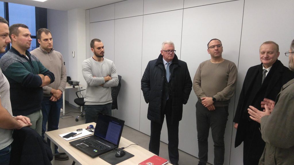
Yesterday we had the honor to receive the visit of the Belarusian Minister for Science at our office in Belgrade Science Park. He was particularly interested in our flagship product Croplab and its many benefits for farmers and agricultural companies! Also, we discussed the vast potential of EO and GIS in several sectors, especially in […]
CropLab free access up to 30 ha in Vojvodina
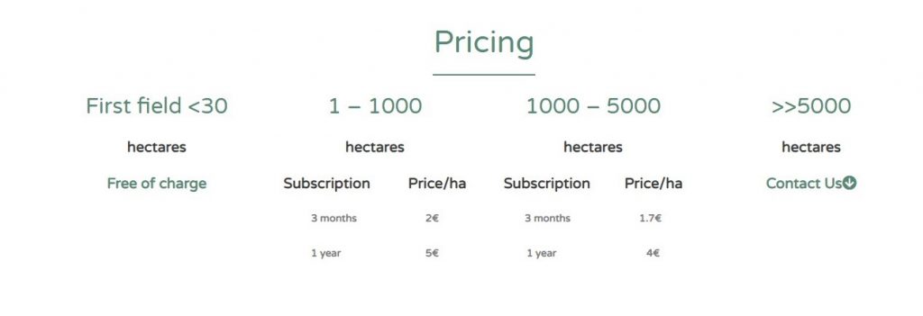
GILab now gives you the opportunity to try ALL CropLab platform services for free for one of your parcels, up to 30 hectares (this is currently possible only for parcels in Vojvodina region, Serbia). Don’t miss the chance to analyze your parcels and crops, just access CropLab website (croplab.info/en), click on Get Started and register!
GILab is proud to announce the Ethiopia DIAD project kick-off
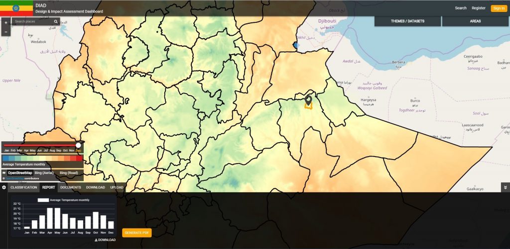
We are proud to announce the Ethiopia DIAD project kick-off. GILab, in collaboration with Wageningen University & Research (WUR) and GIZ Ethiopia, will develop a web-based Design and Impact Assessment Dashboard (DIAD) for landscape exploration and impact assessments via monitoring of site and landscape-level KPIs (physical, agronomic, socio-economic), based to the maximum extent possible on […]
A new Horizon2020 project DIONE starting in January 2020
GiLab is excited to announce it’s participation in H2020 DIONE project that will start in January 2020
DIAD: Design & Impact Assessment Dashboard for Ethiopia

GILab, in collaboration with Wageningen University & Research (WUR) and GIZ Ethiopia, will develop a web-based prototype for Design and Impact Assessment Dashboard (DIAD) for Ethiopian landscape exploration and impact assessments via monitoring of site and landscape-level KPIs (physical, agronomic, socio-economic), based to the maximum extent possible on remote sensing and other remote data technologies.
DIONE: an integrated EO-based toolbox for modernising CAP area-based compliance checks and assessing respective environmental impact
DIONE, a H2020 project, proposes a close-to-market (TRL7) area-based direct payments monitoring toolbox that will address the forthcoming Modernised CAP regulation of using automated technologies to ensure more frequent, accurate and inexpensive compliance checks. Dione will: 1) apply the results of ESA’a SEN4CAP project that showcased the capability of Sentinel data to monitor the crop […]
GiLab has launched its flagship product CropLab!
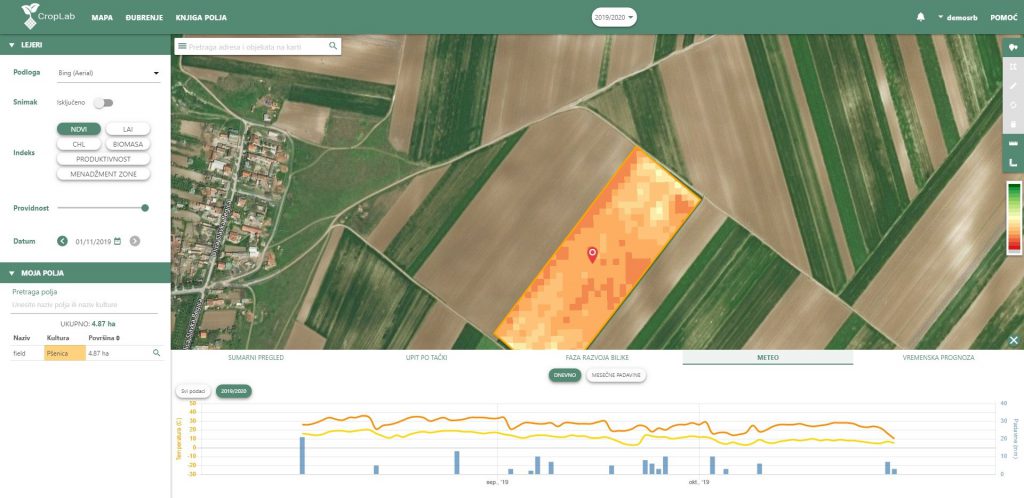
CropLab is an interactive and easy to use platform based on EO data that enables farmers and agronomists to access detailed information about critical indicators that define and influence their crop status, ensuring a more cost-efficient input management, higher yields, and wiser land management. CropLab is an interactive and easy to use platform based on […]
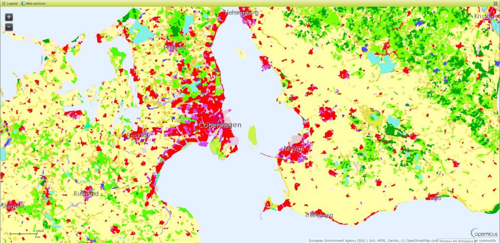
CORINE Land Cover 2018
GILAB was a partner in a consortium that has been awarded a contract by European Environment Agency (EEA) for an implementation of a project entitled “Copernicus Land monitoring services – Production of CORINE Land Cover for the reference year 2018 (CLC2018) for Denmark, Latvia, Switzerland and the West Balkan countries”. We’ve participated in a revision of CLC database for […]
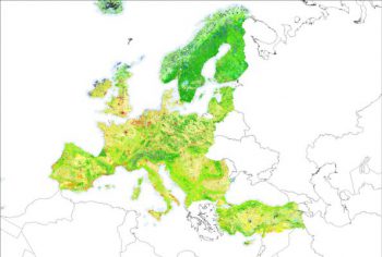
The first official release of LandGIS
GILab team is proud to announce the first release of LandGIS. Web mapping client is available at https://landgis.opengeohub.org Information about LandGIS REST API is located at https://landgisapi.opengeohub.org Data store (metadata/layer preview and dowload) is available at https://maps.opengeohub.org. Web mapping client is available at https://landgis.opengeohub.org Information about LandGIS REST API is located at https://landgisapi.opengeohub.org Data store (metadata/layer preview and dowload) is available at https://maps.opengeohub.org. Web mapping client […]
CORINE Land Cover 2018 – GILab has signed a parternship agreement with Space4environment
Partnership agreements signed with Space4environment (coordinator of the consortium) to provision of services relating to the project “Copernicus Land monitoring services – Production of CORINE Land Cover for the reference year 2018 (CLC2018) for Denmark, Latvia, Switzerland and the West Balkan countries” Partnership agreements signed with Space4environment (coordinator of the consortium) to provision of services […]