CORINE Land Cover 2018
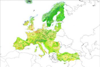
GILAB was a partner in a consortium that has been awarded a contract by European Environment Agency (EEA) for an implementation of a project entitled “Copernicus Land monitoring services – Production of CORINE Land Cover for the reference year 2018 (CLC2018) for Denmark, Latvia, Switzerland and the West Balkan countries”. We’ve participated in a revision of CLC database for […]
CropLab
Demo app for crop monitoring support tool. It provides support to farmers by helping them monitor growth on their farms. In the background, this application uses GeoServer and Rasdaman for layer management, display and data extraction and Django REST framework wiht PostGIS. Farmers are able to see the map with layers such as NDVI (Normalized […]
Land Information and Monitoring Service
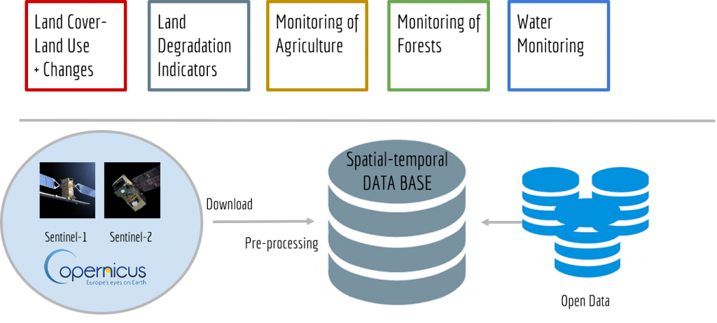
Technical solution and implementation plan for multipurpose Land Information and Monitoring Service for Montenegro. The proposed system should be based on a hyperresolution spatiotemporal land information to support land use planning and land restoration projects
SoilGrids 2015-2019
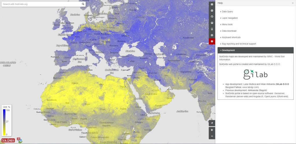
GILAB team made web mapping client for “Soil property maps at 250 m” based on the AngularJS and OpenLayers, 3D client based on the CesiumJS. We made upgrade of REST SoilGrids API. We implemented OGC web mapping services based on the Geoserver, download functionalities based on the Rasdaman and FTP, metadata catalog based on the Geonetwork. GILAB team made web mapping client for “Soil property maps at […]
Meteo Database
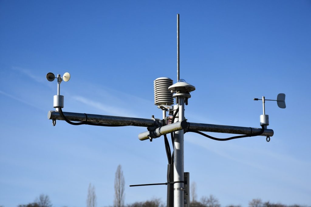
Technical solution and implementation of meteorogical measurements database system. Automatic integration of different data formats and sensors, storing and displaying them through istSOS service which employs OGC SOS standard.
SoilInfo 2015-2019
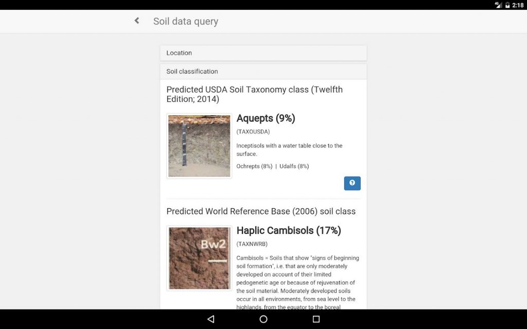
Development of web/Android/iOS app realization of the SoilInfo app. The SoilInfo App is the mobile component of the Global Soil Information Facilities (GSIF). Its main purpose is to provide access to soil data coming from the SoilGrids project, but it also allows display, distribution and query of all other data components (e.g. soil profiles and […]
OpenLandMap
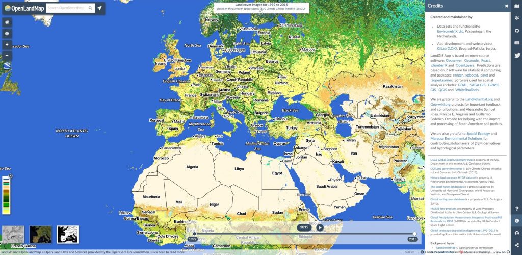
GILab team has developed LandGIS – Web GIS system that consists of (1) Web mapping client, which provides visualization of various spatio-temporal land-related datasets and enables querying per map click, to get layer values in time-series for the point of interest, (2) LandGIS REST API – lightweight, but powerful REST API written in R, that enables querying over multiple datasets (3) Data Store – […]