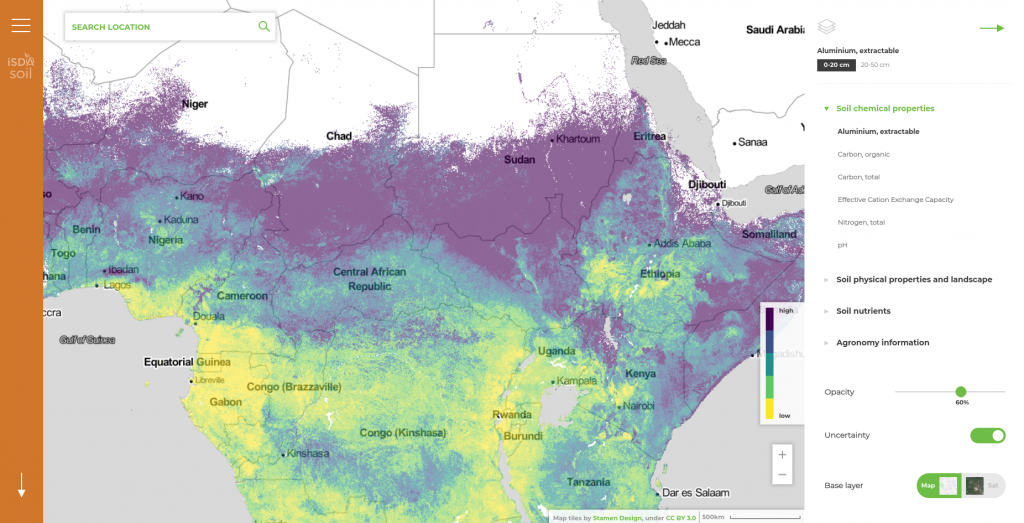
This innovative GIS solution encompasses a web mapping application, facilitating the visualization of various soil-related spatial data and offering the capability to query specific locations within each dataset. Additionally, it features a REST API, empowering users to perform customized spatial queries with user-defined parameters, including longitude, latitude, property, and depth, as detailed in the Developer Portal for further information.