GiLab has launched its flagship product CropLab!
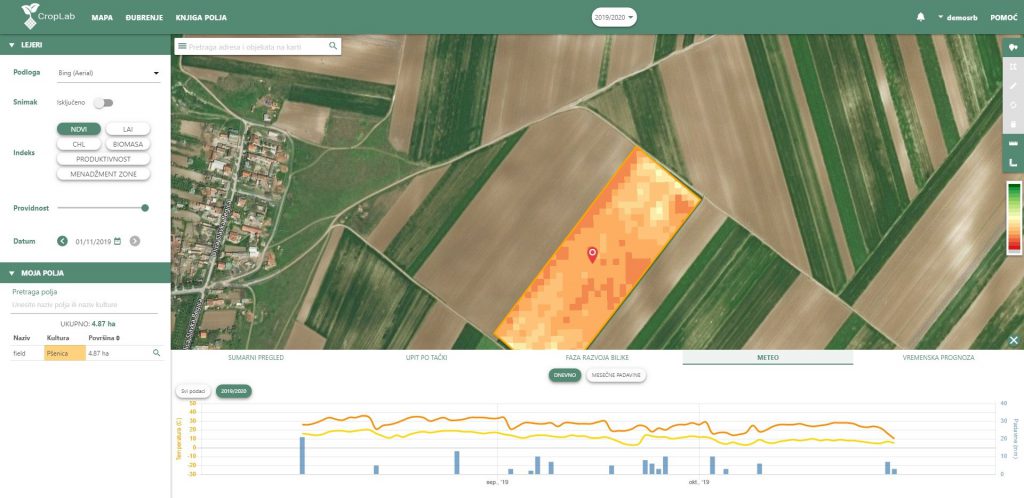
CropLab is an interactive and easy to use platform based on EO data that enables farmers and agronomists to access detailed information about critical indicators that define and influence their crop status, ensuring a more cost-efficient input management, higher yields, and wiser land management. CropLab is an interactive and easy to use platform based on […]
The first official release of LandGIS
GILab team is proud to announce the first release of LandGIS. Web mapping client is available at https://landgis.opengeohub.org Information about LandGIS REST API is located at https://landgisapi.opengeohub.org Data store (metadata/layer preview and dowload) is available at https://maps.opengeohub.org. Web mapping client is available at https://landgis.opengeohub.org Information about LandGIS REST API is located at https://landgisapi.opengeohub.org Data store (metadata/layer preview and dowload) is available at https://maps.opengeohub.org. Web mapping client […]
CORINE Land Cover 2018 – GILab has signed a parternship agreement with Space4environment
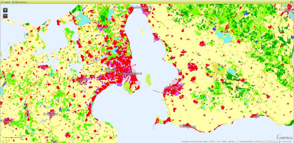
Partnership agreements signed with Space4environment (coordinator of the consortium) to provision of services relating to the project “Copernicus Land monitoring services – Production of CORINE Land Cover for the reference year 2018 (CLC2018) for Denmark, Latvia, Switzerland and the West Balkan countries” Partnership agreements signed with Space4environment (coordinator of the consortium) to provision of services […]
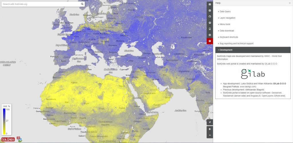
We are pleased to announce, that the SoilGrids is now online
SoilGrids is now online at https://soilgrids.org. There is also a 3D client based on CesiumJS, available at http://soilgrids.org/3d/ SoilGrids maps are developed and maintained by ISRIC – World Soil Information. SoilGrids web portal is created and maintained by GILab D.O.O: App development: Luka Glušica and Milan Kilibarda (GILab D.O.O Beograd-Palilula; www.lab4gi.com) SoilGrids portal is based on open-source software: […]